ediTrail 1.0

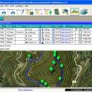
... trail/waypoint. Each trail/route can be edited over the map with vectorial CAD tools to create, move, split, join, invert trails and trackpoints, (trail vertices). ediTrail works in desktop mode and into CAD systems, (Autocad/Bricscad/Zwcad). ...

Author Aplicaciones Topográficas S.L.
License Freeware
Price FREE
Released 2014-11-07
Downloads 197
Filesize 27.05 MB
Requirements Desktop application, MIcrosoft operating systems, 32&64 bits
Installation Install and Uninstall
Keywords Trail, Route, GPS, gpx, geographical, latitude, longitude, utm, elevation, photo, Track, Way Point, Track Point, hiking, biking, cycling, map, land, terrain, surveying, DTM, D.T.M., digital terrain model, AutoCAD, BricsCAD, CAD, draw, points cloud, contouring, triangulation
Users' rating
(7 rating)
ediTrailOtherWin2000, Windows XP, Windows 7 x32, Windows 7 x64, Windows 8, WinServer, Windows Vista, Windows Vista x64
ediTrail world map - Download Notice

Using ediTrail Free Download crack, warez, password, serial numbers, torrent, keygen, registration codes, key generators is illegal and your business could subject you to lawsuits and leave your operating systems without patches. We do not host any torrent files or links of ediTrail on rapidshare.com, depositfiles.com, megaupload.com etc. All ediTrail download links are direct ediTrail full download from publisher site or their selected mirrors.
Avoid: world map oem software, old version, warez, serial, torrent, ediTrail keygen, crack.
Consider: ediTrail full version, world map full download, premium download, licensed copy.

ediTrail world map - The Latest User Reviews

Most popular Other downloads

ExpertGPS

9.10 download

... the standout features of ExpertGPS is its extensive map library. Users have access to high-resolution aerial imagery, ... the software to their specific needs. From customizing map symbols and labels to creating personalized templates for ...

Windows Maps

11.2411.7.0 download

... interface allows users to easily switch between different map views, including road, aerial, and street-level perspectives, providing a rich visual experience. One of the standout features of Windows Maps ...

ediTrail

1.0 download

... with inheritance of data, attributes, etc. Presentation on map: View on map in accordance with the active trail, which comes ... mode (photos, orthophotos, etc), as 'Map' mode, (Topographic map, street maps, etc). Digital Terrain Model, DTM: I ...

KidsMouse

3.2 download

... "Color Ball", "Easy Puzzle", "Crayon","Seesaw","Number Puzzle","Shape Puzzle","Flowerpot","USA Puzzle","World Map Puzzle","Clock","Animal Block" , "Order Maze","Fish" and "Missing Word".Can operate all games only by a click and drag & drop with a ...

MapTiler Engine

14.0.2 download

... who need to transform geospatial data into high-quality map tiles. This powerful tool excels in converting raster ... user-friendly interface, which simplifies the complex process of map tiling. Users can effortlessly upload their geospatial data, ...

Desktop Projector

3.4.0 download

... software tool designed to transform and visualize global map projections. This innovative application caters to a broad ... hobbyists, providing an intuitive platform for exploring the world through various map projections. At its core, ...

Google Earth for Mac OS X

7.3.6.10155 download

... and versatile geographical exploration tool that brings the world to your fingertips with remarkable precision and detail. ... indispensable resource for anyone interested in understanding our world in greater detail. Whether you're a professional needing ...

KidsMouse for Mac

3.2 download

... "Color Ball", "Easy Puzzle", "Crayon","Seesaw","Number Puzzle","Shape Puzzle","Flowerpot","USA Puzzle","World Map Puzzle","Clock","Animal Block" , "Order Maze","Fish" and "Missing Word".Can operate all games only by a click and drag & drop with a ...

Metes and Bounds

6.2.4 download

... and Bounds turns data into a deed plot map. It can calculate square feet, acreage and hectares. Enter measurements in rods, chains, meters, yards, inches, fathoms, hands, spans ...