ediTrail 1.0

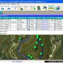
You can manage unlimited trails/routes on a simple and flexible table where you can export and import from GPS files, (gpx format). You can manage/view on table all the taken photographs in each trail/waypoint. Each trail/route can be edited over the map with vectorial CAD tools to create, move, split, join, invert trails and trackpoints, (trail vertices). ediTrail works in desktop mode and into CAD systems, (Autocad/Bricscad/Zwcad). ...

Author Aplicaciones Topográficas S.L.
License Freeware
Price FREE
Released 2014-11-07
Downloads 189
Filesize 27.05 MB
Requirements Desktop application, MIcrosoft operating systems, 32&64 bits
Installation Install and Uninstall
Keywords Trail, Route, GPS, gpx, geographical, latitude, longitude, utm, elevation, photo, Track, Way Point, Track Point, hiking, biking, cycling, map, land, terrain, surveying, DTM, D.T.M., digital terrain model, AutoCAD, BricsCAD, CAD, draw, points cloud, contouring, triangulation
Users' rating
(6 rating)
ediTrailOtherWin2000, Windows XP, Windows 7 x32, Windows 7 x64, Windows 8, WinServer, Windows Vista, Windows Vista x64
ediTrail world view - Download Notice

Using ediTrail Free Download crack, warez, password, serial numbers, torrent, keygen, registration codes, key generators is illegal and your business could subject you to lawsuits and leave your operating systems without patches. We do not host any torrent files or links of ediTrail on rapidshare.com, depositfiles.com, megaupload.com etc. All ediTrail download links are direct ediTrail full download from publisher site or their selected mirrors.
Avoid: world view oem software, old version, warez, serial, torrent, ediTrail keygen, crack.
Consider: ediTrail full version, world view full download, premium download, licensed copy.

ediTrail world view - The Latest User Reviews

Most popular Other downloads

Virtual Celestial Globe

1.2.7d download

VirtualCelestialGlobe 1.2.7b World Globe 0.0.7 A simple java 3d virtual celestial and world globe. Rotate the globe, magnify it, select the ... GL Package contains also Astronomical tools: Planetarium JMoon View 1.0.0 JSky View 1.0.0 Star Visibility Julian date ...

Kodu

1.3.1 download

... and path builder * Terrain editor - create worlds of arbitrary shape and size * 20 different characters with different abilities ...

Google Earth

7.3.6.10155 download

... travelers, and anyone with a curiosity about the world. At its core, Google Earth allows users ... globe with ease, zooming in from a global view to detailed street-level perspectives. The software's intuitive navigation ...

Earth Alerts

2024.1.182 download

... hazard events that are occurring anywhere around the world. Alert notifications, reports, and imagery provide the user with a convenient way to view natural phenomenon as they occur, whether close to ...

ExpertGPS

9.05 download

... capabilities make it a standout choice in the world of GPS mapping software. ...

IP Video System Design Tool

2024.0.0.2292 download

... is its advanced camera placement and field of view simulation. Users can visualize the coverage area of ... These reports can include camera specifications, field of view diagrams, bandwidth and storage calculations, and other essential ...

MacJournal

6.2.1 download

... for you. We’ve created and designed MacJournal, the world’s most popular journaling application for the Mac, so ... type, you can use the Statistics menu to view Words, Characters and Lines in an entry. If ...

Drudge Reader for Windows Phone

4.6.0 download

... Report App, optimized for quick access and easy viewing of the Drudge Report at the tap of ... Reader for a quick and easy way to view pictures and articles from the official Drudge Report ...

Desktop Projector

3.4.0 download

... hobbyists, providing an intuitive platform for exploring the world through various map projections. At its core, ... or a curious novice, G.Projector opens up a world of possibilities for exploring and understanding our planet. ...

ediTrail

1.0 download

... inheritance of data, attributes, etc. Presentation on map: View on map in accordance with the active trail, ... a point every 90 metres from around the world and 30 meters for United States, (DEM, digital ...