- Software
- - Graphic Apps
- - Editors
- - 3DField
3DField 4.6.7.0
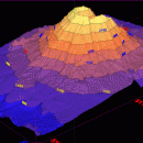
"3DField" by Vladimir Galouchko is a robust and versatile software designed for the creation of 3D surface maps and contour plots from your data sets. This powerful tool caters to a wide range of applications, from scientific research and engineering to environmental studies and geospatial analysis.
One of the standout features of 3DField is its user-friendly interface, which allows both novice and experienced users to navigate through its extensive functionalities with ease. The software supports a variety of data formats, making it highly adaptable to different data sources. Whether you're working with XYZ data, grid files, or even directly importing from Excel, 3DField ensures a seamless integration process.
The software excels in its rendering capabilities, producing high-quality 3D surface maps that are both visually appealing and highly informative. Users can customize their maps extensively, adjusting parameters such as color gradients, lighting, and perspective to highlight specific data trends and insights. The contour plotting feature is equally impressive, offering precise and detailed contour lines that can be fine-tuned to meet specific analytical needs.
3DField also includes advanced interpolation methods, allowing users to generate smooth and accurate surfaces from scattered data points. This is particularly useful for applications in geosciences, where data points may be irregularly spaced. The software's ability to handle large datasets efficiently ensures that even complex projects can be managed without performance issues.
Another notable feature is the software's export capabilities. 3DField allows users to export their maps and plots in various formats, including high-resolution images and 3D models, which can be easily shared or integrated into other software applications. This flexibility makes it an excellent tool for collaborative projects and presentations.
In terms of performance, 3DField is optimized to handle intensive computational tasks without compromising on speed or accuracy. The software's robust algorithms ensure that data processing is both quick and reliable, providing users with accurate results in a timely manner.
Vladimir Galouchko has also ensured that 3DField is continuously updated, incorporating user feedback and the latest technological advancements. This commitment to improvement keeps the software relevant and up-to-date with the evolving needs of its user base.
In summary, 3DField is a comprehensive and efficient tool for anyone needing to create detailed 3D surface maps and contour plots. Its combination of user-friendly design, advanced features, and high performance makes it a valuable asset for professionals across various fields. Whether you're a scientist, engineer, or geospatial analyst, 3DField offers the tools you need to visualize and interpret your data with precision and clarity.
| Author | Vladimir Galouchko |
| License | Demo |
| Price | FREE |
| Released | 2024-08-13 |
| Downloads | 800 |
| Filesize | 11.50 MB |
| Requirements | |
| Installation | |
| Keywords | surface, map, data visualization, digitize image, mapping software, plotter, surface plot, mapper |
| Users' rating (16 rating) |
Using 3DField Free Download crack, warez, password, serial numbers, torrent, keygen, registration codes,
key generators is illegal and your business could subject you to lawsuits and leave your operating systems without patches.
We do not host any torrent files or links of 3DField on rapidshare.com, depositfiles.com, megaupload.com etc.
All 3DField download links are direct 3DField full download from publisher site or their selected mirrors.
Avoid: oem software, old version, warez, serial, torrent, 3DField keygen, crack.
Consider: 3DField full version, full download, premium download, licensed copy.


