Panoply for Mac 5.4.3
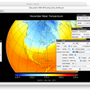
Panoply for Mac is a cross-platform application which plots geo-gridded arrays from netCDF, HDF and GRIB datasets. Panoply is designed to help you view and process the data included in netCDF, HDF, GRIB, and other types of databases, in order to generate geo-gridded plots. Since the application deploys on the Java Runtime, Panoply can be used on multiple platforms.
The Panoply user interface is organized into multiple tabs that help you browse between datasets and catalogues, to adjust the scale range, to customize labels, vectors, to overlay masks, and so on. All in all, finding your way around proves to be fairly intuitive. The utility can also combine two arrays and can project the analysis using more than 100 maps. What’s more, you get to overlay continent, or other types of masks on top of the generated arrays.
You can:
Create color contour plots of geo-referenced latitude-longitude, latitude-vertical, longitude-vertical, time-latitude or time-vertical arrays sliced from 2D or larger multidimensional variables.
Create color contour plots of "generic" 2D arrays from 2D or larger multidimensional variables.
Create line plots of data from 1D or larger multidimensional variables.
Combine two geo-referenced arrays in one plot by differencing, summing or averaging.
Create map plots of trajectory data based on the CF convention or similar.
Plot lon-lat data on a global or regional map using any of over 200 map projections or make a zonal average line plot.
Overlay continent outlines or masks on lon-lat map plots.
Use any of numerous color tables for the scale colorbar, or apply your own custom ACT, CPT, or RGB color table.
Save plots to disk GIF, JPEG, PNG or TIFF bitmap images or as PDF or PostScript graphics files.
Export lon-lat map plots in KMZ format.
Export animations as MP4 video or as a collection of invididual frame images.
Explore remote THREDDS and OpenDAP catalogs and open datasets served from them.
| Author | Robert B. Schmunk |
| License | Freeware |
| Price | FREE |
| Released | 2024-06-24 |
| Downloads | 275 |
| Filesize | 36.40 MB |
| Requirements | |
| Installation | Instal And Uninstall |
| Keywords | plot raster image, longitude image, pole-to-pole image, raster image, rasterize, raster |
| Users' rating (25 rating) |
Using Panoply for Mac Free Download crack, warez, password, serial numbers, torrent, keygen, registration codes,
key generators is illegal and your business could subject you to lawsuits and leave your operating systems without patches.
We do not host any torrent files or links of Panoply for Mac on rapidshare.com, depositfiles.com, megaupload.com etc.
All Panoply for Mac download links are direct Panoply for Mac full download from publisher site or their selected mirrors.
Avoid: oem software, old version, warez, serial, torrent, Panoply for Mac keygen, crack.
Consider: Panoply for Mac full version, full download, premium download, licensed copy.


