- Software
- - Development
- - Delphi
- - PlotLab VCL
PlotLab VCL 8.0
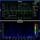
... especially suitable for FFT results. The components allow zooming, navigation, direct printing, clipboard copy, save to file and more. Optimized for very fast data plotting, and support multithreading. Free for non-commercial use. ...
| Author | Mitov Software |
| License | Free To Try |
| Price | $289.00 |
| Released | 2024-08-19 |
| Downloads | 1082 |
| Filesize | 1661.08 MB |
| Requirements | Delphi or C++ Builder 12.0 or higher |
| Installation | Install and Uninstall |
| Keywords | Chart, Scope, Plot, Waterfall, Plotting, Graph, Delphi, C++ Builder, RAD Studio, VCL, FireMonkey, FMX, Components, Libraries, Component, Library |
| Users' rating (11 rating) |
Using PlotLab VCL Free Download crack, warez, password, serial numbers, torrent, keygen, registration codes,
key generators is illegal and your business could subject you to lawsuits and leave your operating systems without patches.
We do not host any torrent files or links of PlotLab VCL on rapidshare.com, depositfiles.com, megaupload.com etc.
All PlotLab VCL download links are direct PlotLab VCL full download from publisher site or their selected mirrors.
Avoid: pan zoom oem software, old version, warez, serial, torrent, PlotLab VCL keygen, crack.
Consider: PlotLab VCL full version, pan zoom full download, premium download, licensed copy.

