- Software
- - Graphic Apps
- - Editors
- - 3DField
3DField 4.6.7.0
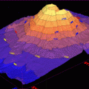
3DField, developed by Vladimir Galouchko, is a powerful visualization tool designed for creating stunning 3D surface plots from your data. Its intuitive interface allows users to easily import datasets and generate detailed maps, making it ideal for scientists, engineers, and researchers. With customizable features, including color gradients and contour lines, 3DField transforms complex data into visually appealing graphics. Whether for presentations or analysis, this software enhances data inte ... ...
| Author | Vladimir Galouchko |
| License | Demo |
| Price | FREE |
| Released | 2024-08-13 |
| Downloads | 793 |
| Filesize | 11.50 MB |
| Requirements | |
| Installation | |
| Keywords | surface, map, data visualization, digitize image, mapping software, plotter, surface plot, mapper |
| Users' rating (9 rating) |
Using 3DField Free Download crack, warez, password, serial numbers, torrent, keygen, registration codes,
key generators is illegal and your business could subject you to lawsuits and leave your operating systems without patches.
We do not host any torrent files or links of 3DField on rapidshare.com, depositfiles.com, megaupload.com etc.
All 3DField download links are direct 3DField full download from publisher site or their selected mirrors.
Avoid: scientific applications oem software, old version, warez, serial, torrent, 3DField keygen, crack.
Consider: 3DField full version, scientific applications full download, premium download, licensed copy.


